RSS Feeds
Antietam National Battlefield - Hiking Trail #1
Hiking Trail - The Cornfield
Antietam National Battlefield has established this hiking trail for the sake of visitors who wish to explore the terrain around "The Bloody Cornfield" in more detail then that provided by the driving tour.
It is of course, possible to enjoy the battlefield tour without going on the hike, but history buffs will be rewarded by the trail that follows in the footsteps of Union soldiers as they advanced into battle in the pre-dawn light of September 17th 1862, and into the inferno of combat in the corn. Indeed, anyone who enjoys a good hike will be glad they went.
The National Park Service sells a tour map and pamphlet at the Visitor Center for a mere $2.00.
The map is also downloadable from the NPS site here.
http://www.nps.gov/anti/planyourvisit/hiking.htm
In addition, the website CivilWarTraveller.com provides a downloadable podcast for free. The podcast is narrated to match the tour stops.
http://www.civilwartraveler.com/audio/index.html
The tour begins at driving Tour Stop #2 (The Poffenberger Farm) The trail is 1.6 miles long, and takes between an hour and an hour and a half. Be careful of the groundhog holes and poison ivy.
Stop 1 – Parking area and Auto Tour Stop 2
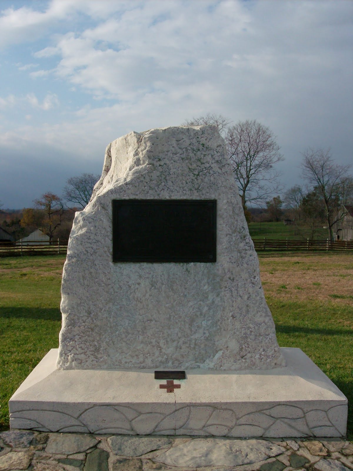
(Fence across the street from the parking lot and Clara Barton monument)
Restless Night
This spot was the edge of the Union encampment on the night of Sept 16th -17th. The camps of General Joseph Hooker's 1st Corps were spread out to the north on the Poffenberger's fields. The Confederate troops under Thomas J "Stonewall" Jackson were mostly posted in the area of cornfield of the Miller farm, a half mile south. Cannons backed them up on the mild plateau near the Dunker Church.
Everyone slept knowing a fight was going to happen in the morning. Many were surprised that it had not happened the day before. On the 16th, in broad daylight, the Union 1st and 12th Corps splashed across the Antietam Creek to reach this staging area. Only a mild skirmish had occurred. And so the two armies bedded down for the night of the 16th, knowing that many of their friends would be dead within a day.
Hooker's orders from General McClellan (Commander of the Union Army of the Potomac) were to move out at first light and attack the Confederate positions. The responsibility for opening the battle would be his. Among his several vices, Hooker was given to boast, but he didn't need to stretch the truth on the night of the 16th. He commented to the several reporters that were constantly following him around, that "Tomorrow we will fight the battle that would decide the fate of the Republic".
General Hooker was an aggressive fighter, and was eager to carry out his orders. He had his soldiers on their feet at 5:00 am.
Directly south of this spot was a small woodlot known as the North Woods. An astute visitor will notice that there are many short, young trees in the immediate area. This is because the NPS is replanting the North Woods in an effort to restore the battleground to its Sept 1862 appearance.
Hiking south from Stop 1 to Stop 2 follows in the footsteps of Union soldiers as they left their camps, and crossed the North Woods.
Stop 2 – Out the Woods and Into the Fire
Battle Lines
As the soldiers woke up and formed up their battle lines, sporadic gunshots were heard. That was the skirmishers on both sides probing their opposing lines. The Union battle line of the 1st Corps was extensive, over a half mile long. One division of Union troops under Gen. Abner Doubleday stepped out of the North Woods at this point. Another division under Gen. James Ricketts formed up on the left. Behind, still back at the farm was the division of General George Gordon Meade.
Incoming!
The minute Doubleday’s men left the safety of the timberline, they were under attack by Confederate artillery. On their right flank, across the Hagerstown Pike was a ridge known as Nicodemus Heights. It is all private property today, and the heights are tree covered now. In 1862, the ground was open – and occupied by Confederate Major John Pelham’s dozen or so cannons. That number wasn’t enough to thwart the Union attack, but their advantageous position – combined with Pelham’s natural pluck and tenacity meant that these guns would punch above their weight.

Pelham’s cannons were aimed perfectly – the third shot landed in the middle of the 6th Wisconsin, killing 2 soldiers and wounding 11. Cannons from both sides joined in on the fight. More Confederate cannon engaged – those under Col. Stephen D. Lee (no close relation to the Robert E. Lee) deployed on the plateau near the Dunker Church. No Union soldier could doubt that they were in harms way. Far across the Antietam Creek, long range Union canons attempted to suppress the Confederate guns.
The Sparkling Corn
Hooker, Doubleday, and other Union officers had a much better view then their soldiers, (who had the same view the average hiker has) – they were on their horses, and their point of view was nine feet in the air. From there, they could see a foreboding sight. A half-mile away, the September sunlight caused a glistening, sparkling effect in the Miller cornfield. Thousands of Confederate soldiers, their bayonets and polished gun barrels catching the rising sun, were waiting for them.
Hiking from Stop 2 to Stop 3 traverses the Union line of battle. The hiker moves west, along what were once the ranks of Doubleday’s and then Ricketts’ men. After taking a sharp right hand turn, the hiker moves south, following in the footsteps of Ricketts’ division.
Stop 3 – Tricky Terrain an A Complicated Advance
Artillery Reaping
Immediately to the right is a subtle roll in the ground. As Doubleday and Ricketts advanced, Hooker noticed that the cornfield in front of him was filled with Confederates. Altering his battle plan slightly, he halted his infantry, and ordered 2 batteries of cannons (12 guns) to park hub-to-hub on that high ground, and destroy the Miller Cornfield and the Confederates therein. The cannons blazed away at point-blank range, firing shrapnel or ‘case shot’, an anti-personnel weapon. It was essentially a bomb fired from a cannon that was timed with a fuse to explode at a certain range. When the bomb exploded, bullets that were packed inside as well as fragments of shell scattered everywhere, killing, crippling and maiming anyone nearby. Hooker’s gunners had cut their fuses down to one-and-a-half seconds.

Tough Going
Moving a line of men a mile or so south would seem like a simple enough task. Battles however are nothing if not chaotic and unpredictable, and plans are often wrecked very soon after the first shot is fired. This happened at Antietam. Ricketts’ attack fell victim to every difficulty that could occur to a division. Confederate artillery killed and wounded soldiers as they advanced. The presence of the Union cannons delayed Doubleday, but didn’t delay Ricketts, chopping up the Federal attack. The hills and rolls in the terrain- to say nothing of the battle smoke - made it difficult to keep track of nearby friendly units.
Duryea Alone
One of Ricketts’ three brigade commanders was wounded and had to leave the field. A second brigade commander panicked at the shellfire and ran away, abandoning his troops. Only the third brigade, under General Abram Duryea made initial contact with the Confederates on schedule. Although the other two brigades would recover from their difficulties and join the fight, Duryea would begin this fight alone, and loose almost half his 1,000 men in just 30 minutes of combat.
Hiking from Stop 3 to Stop 4 continues in the footsteps of Ricketts’ men, to the point just before they entered the “Bloody Cornfield”.
Stop 4 - Corner of Death at Antietam
The worm fence marks the boundary of the Cornfield. Ricketts Union division, one brigade at a time, made deadly contact with Stonewall Jackson’s defending Confederates, pushing through the corn. Simultaneously, Doubleday’s men engaged to the west. As the battle progressed, the Cornfield would change hands several times. Troops who arrived later in the battle noticed that the horrible carnage followed a pattern- the worst casualties would always be at the edge of a landscape feature such as a woodlot, a roadway and this cornfield. Many of Ricketts men would meet their deaths at the southern end of this cornfield.

Counterattacking Confederate men would die in large numbers at this (northern) edge of the cornfield.
Hiking from Stop 4 to Stop 5 again traverses the Union line of battle, walking back along Ricketts’ lines and reaching Doubleday’s lines. Walk west along the northern border of the Cornfield to Stop 5
Stop 5 – The Most Sacred Ground – The Cornfield
The hiker is about to enter the David R. Miller Cornfield. This is the some of the most sacred and hallowed ground in the United States. Thousands of Union and Confederate soldiers died in these 30 acres of maize, as it changed hands time and again.
The reason why the cornfield was so dangerous is simple. Soldiers waiting on the other side of the cornfield couldn’t get clean shots at the men coming through the corn, and thus held their fire until the enemy reached the edge. When the soldiers finally opened fire, they did so at almost point-blank range. When Union troops first reached this point, they plunged into the corn, and the battle was joined at the southern edge. Later, when Confederate troops counterattacked, they themselves met a wall of lead from Union reinforcements at this the northern edge.
Union General John Gibbon commanded the first brigade of Doubleday’s men to enter the corn. Because of their bravery at the battles of Second Manassas and South Mountain, they had been dubbed The Iron Brigade. These Midwestern boys, men from Wisconsin and Indiana, took pride in both their nickname, and their army designation – the 1st Brigade of the 1st Division of the 1st Corps.
As the Midwesterners reached this point, they could see the dead and dying Confederates laying in the wrecked cornfield, the victims of the point-blank bombardment ordered by General Hooker. The Confederate battle line had by now abandoned the badly damaged cornfield and had regrouped on the other side of it.

Hiking from Stop 5 to Stop 6 follows in the footsteps of the Iron Brigade as they marched through the cornfield.
Stop 6 – Georgian Defense and Texas Counterattack
Douglas vs. The Iron Brigade
Col. Marcellus Douglas commanded the Confederate brigade in this area. His men bore the brunt of the artillery bombardment, and now braced for the Iron Brigade’s attack. The gray Georgia Monument to the left honors Douglas’s Georgians. As Gibbon’s Iron Brigade reached this southern edge of the cornfield, they receive their first volley at close range. Pausing at the edge of the corn, the Midwesterners fired back and the battle of Antietam was on in earnest. Hundreds of men dropped from the ranks, some killed on the spot, some wounded, but able get themselves to the rear, and others wounded so badly they could do nothing but lay there and plead for help.
Confederate Collapse
Douglas’s Confederates got the worst of this fight, having already been shocked and bloodied by the artillery. Another Confederate brigade arrived to support them, these men Louisianans under General Harry Hays. They filed in next to the Georgians, and were demolished by Ricketts men, who were, as we know covering Doubleday’s left. In a short time, both Douglas’ and Hays’ commands had lost more then half their men, and were retreating. Douglas himself was killed by an artillery shell that blew him into the air.
Gibbon’s cheering men of iron charged beyond the cornfield, followed by their reinforcements. The men of Doubleday’s division then caught a third Confederate brigade under Gen. William Starke in a murderous crossfire. After an intense firefight, during which at one point the two forces blasted away at each other from opposite sides of the Hagerstown Pike, Starke’s men were also put to flight. It was only 7:00 in the morning and already the Confederate battle line was breaking into pieces! Could anything stop the 1st Corps?
Lone Star
The rose colored monument directly across Cornfield Avenue holds the answer. It is the Texas Monument, and represents the very last reinforcements that Stonewall Jackson had available to him. General John Bell Hood’s Texans were held in reserve about a half mile away behind the Dunker Church (visible from this point between the trees). These men were all Jackson had to depend on, but they were some of the best.
The Texas Brigade had not only Texans but also Alabamians and Mississippians in their ranks. These men from the Confederate West had a reputation for being the roughest and toughest brawlers in the Confederate Army, and they took pride in living up to it. Being held in reserve, they had just started their cooking fires and were about to chow down on breakfast. Since they had been on the march for most of the campaign, it would have been their first hot-cooked meal in three days.
Before a single morsel could be eaten, the order to fall in and march to the front was given. The men of the Texas Brigade did not like this. Not one bit.
Lining up by the Dunker Church (and present day Visitor Center), the enraged Texans let out the Rebel Yell and charged into the Yankees who had dared to interrupt their meal. By now Doubleday’s men were fought out, low on ammunition, and fell back through the Cornfield, with the angry Texans right behind them.

The Texans themselves would then be crushed by Gen George Meade’s division of Union infantry and by the cannons that Hooker had deployed on the open ground to the north. The 1st Texas regiment would loose 82% of its men. The arrival of the Union 12th Corps from the east compelled Hood’s survivors to abandon this horrible Cornfield.
Hiking from Stop 6 to Stop 7 follows in the footsteps of Hood’s charging Confederates north along the Hagerstown Road.
Stop 7 – The Bugler and the General
Across the Hagerstown Pike are two cannons, representing a battery (six guns) of Union artillery. These guns were moved forward during the initial Union advance and fired on Douglas’ Confederates as the fight got underway. Perhaps it was even a shell from one of these guns that killed Col. Douglas. Such proximity to fighting infantry was incredibly dangerous, and this battery (Battery B, 4th US Artillery) took the casualties to prove it, almost 50 % including its commander.
When Hood’s Texans counterattacked, an already dangerous position became practically suicidal. There was no time to limber up the guns and retreat – the artillerymen had to either fight and win, or be overrun.
The soldiers manning the guns had just the ammunition for this sort of work – canister. Another anti-personnel weapon, canister consisted of a thin metal can packed with iron balls, like a very large load of buckshot. It could be used only at very short range. When a canister round was fired, the tin can flew apart immediately upon leaving the barrel sending the iron balls scattering everywhere. It turned the cannon into a huge shotgun. The cannons could also be loaded with two or even three rounds of canister for when things got desperate.
When Hood’s men counterattacked, things got desperate.
The effect of a blast of canister upon a line of infantry was possibly the most grisly sight in a war filled with grisly sights. The iron balls shredded human flesh, and ripped men apart where they stood. Arms and heads were torn off and thrown hither and yon. Such effects could happen from one cannon firing one load of this awful weapon. There were six cannons here, the surviving artillerymen fighting for their lives. Each cannon was loaded with at least double canister. Dozens of men would be killed and wounded in a single blast.
With half the men of the battery killed and wounded, and the battery in danger of being overrun, all hands were needed to work the guns. The battery’s bugle boy, 15-year-old Johnny Cook jumped to the task and helped load and fire the pieces. Before the war, Cook had been a Cincinnati paperboy. Before Antietam, he had been a bugler, one of the countless lads who joined up and usually served in non-combat roles, despite being very much in harms way. After Antietam he was a hero, awarded the Medal of Honor for his extreme courage in the face of mortal danger.
General John Gibbon needed these cannons’ firepower to protect his Iron Brigade. Having had training in artillery, he dismounted from his horse, loaded one of the pieces, and sighted it himself to make sure the blast was accurate.
The Confederates charged these cannons, but did not reach them. They were blasted to pieces within a few yards of the smoking muzzles of the guns. When the Union 12th Corps arrived on the battlefield, and pushed off the remaining Confederates, the combat mercifully died down in this, the bloodiest sector of the bloodiest day of the war.
Hiking from Stop 7 to Stop 8 follows the Hagerstown Road back towards Tour Stop 1. These would be the footsteps of a wounded Union soldier, limping back towards the Poffenberger Farm and medical aid.
Stop 8 -- The Miller Farm
The Northern side of the Miller Cornfield marks the furthest advance of Hood’s counterattack. Here’s were the Texans were brutally smashed by General Meade’s Pennsylvanians.
The battle of Antietam continued to rage in other sectors of the field – The West Woods, The Sunken Road, Burnside’s Bridge, and the Otto Farm would all see their share of horrors on that day, but perhaps only the Sunken Road would present a sight as grotesque as the Miller’s Cornfield.
City of Blue
After the battle, General McClellan declined to aggressively pursue Lee’s army. The Union Army stayed put in the fields around Sharpsburg. For two months, the 1200 residents of Sharpsburg reluctantly played host to 80,000 soldiers. From a certain way of looking at things, Sharpsburg became the tenth largest city in America, surpassing Buffalo, NY in population for that period of time!
80,000 soldiers had their needs, and that included wood for cooking and campfires. Entire woodlots went up in flames day by day, a tree at a time. The wooden fences has also mostly been knocked down. Even the ones that weren’t in the thick of the fighting were often knocked down simply because they were in the way. Farmers, of course build fences for a reason, and the end of the fences meant that livestock could start roaming free. That was fine by the soldiers. Although the soldiers were forbidden from stealing from the farmers, a chicken or swine that wandered into a camp full of hungry troops would probably not be seen again. Farmers like David Miller naturally resented the soldier’s continued presence, and described them as “two-legged-locusts”.
An Army of Germs was carried with the Army of the Potomac. Disease spread rapidly. Most of the armies on both sides were made up of country boys, and the army was the first time they were crowded together with city boys. Men from rural areas had much less immunity and were far more susceptible to contagious illness. Throughout the Civil War, sickness would kill 2 soldiers for every one who died in battle. Army camps were often lacking in even the most basic sanitation. The presence of the dirty army was a health threat to the residents of the area, and many got sick. David Miller’s brother Daniel became ill and died shortly after the battle.
The Miller House on top of the hill on the hiker’s side of the street was a witness to the battle. So too was the barn on the opposite side of the street. The other buildings were built later.
The hiking trail concludes by winding its way up to the north and northeast. It cuts through the North Woods, allowing the hiker to observe the growing young trees. The trail ends at Tour Stop 1.
Conclusion
The trail has cut through the scene of some of the worst fighting in US history. No man who fought through it and survived it would ever forget it. The Civil War had many battles, and many of those battles had landscapes that were named for the savagery of their fighting. Gettysburg had the Devil’s Den, The Wheatfield, The Peach Orchard Little Round Top, the Railway Cut, and The Angle. Fredericksburg had Marye’s Heights. Spotsylvania had The Bloody Angle. Shiloh had The Bloody Pond.
The Iron Brigade’s Major Rufus Dawes, a combat veteran of almost every battle fought by the Army of The Potomac, was traumatized by this combat more then any battle previous or following. It “surpassed anything, on any other battlefield of my observation …” The sanguine 1st Corps commander, Joseph Hooker agreed. “It was never my fortune to witness a more bloody, dismal battlefield.”
The Antietam National Battlefield has several other hiking trials, including the Sunken Road, Burnside’s Bridge, and The Final Attack trail
Antietam National Battlefield has established this hiking trail for the sake of visitors who wish to explore the terrain around "The Bloody Cornfield" in more detail then that provided by the driving tour.
It is of course, possible to enjoy the battlefield tour without going on the hike, but history buffs will be rewarded by the trail that follows in the footsteps of Union soldiers as they advanced into battle in the pre-dawn light of September 17th 1862, and into the inferno of combat in the corn. Indeed, anyone who enjoys a good hike will be glad they went.
The National Park Service sells a tour map and pamphlet at the Visitor Center for a mere $2.00.
The map is also downloadable from the NPS site here.
http://www.nps.gov/anti/planyourvisit/hiking.htm
In addition, the website CivilWarTraveller.com provides a downloadable podcast for free. The podcast is narrated to match the tour stops.
http://www.civilwartraveler.com/audio/index.html
The tour begins at driving Tour Stop #2 (The Poffenberger Farm) The trail is 1.6 miles long, and takes between an hour and an hour and a half. Be careful of the groundhog holes and poison ivy.
Stop 1 – Parking area and Auto Tour Stop 2
(Fence across the street from the parking lot and Clara Barton monument)
Restless Night
This spot was the edge of the Union encampment on the night of Sept 16th -17th. The camps of General Joseph Hooker's 1st Corps were spread out to the north on the Poffenberger's fields. The Confederate troops under Thomas J "Stonewall" Jackson were mostly posted in the area of cornfield of the Miller farm, a half mile south. Cannons backed them up on the mild plateau near the Dunker Church.
Everyone slept knowing a fight was going to happen in the morning. Many were surprised that it had not happened the day before. On the 16th, in broad daylight, the Union 1st and 12th Corps splashed across the Antietam Creek to reach this staging area. Only a mild skirmish had occurred. And so the two armies bedded down for the night of the 16th, knowing that many of their friends would be dead within a day.
Hooker's orders from General McClellan (Commander of the Union Army of the Potomac) were to move out at first light and attack the Confederate positions. The responsibility for opening the battle would be his. Among his several vices, Hooker was given to boast, but he didn't need to stretch the truth on the night of the 16th. He commented to the several reporters that were constantly following him around, that "Tomorrow we will fight the battle that would decide the fate of the Republic".
General Hooker was an aggressive fighter, and was eager to carry out his orders. He had his soldiers on their feet at 5:00 am.
Directly south of this spot was a small woodlot known as the North Woods. An astute visitor will notice that there are many short, young trees in the immediate area. This is because the NPS is replanting the North Woods in an effort to restore the battleground to its Sept 1862 appearance.
Hiking south from Stop 1 to Stop 2 follows in the footsteps of Union soldiers as they left their camps, and crossed the North Woods.
Stop 2 – Out the Woods and Into the Fire
Battle Lines
As the soldiers woke up and formed up their battle lines, sporadic gunshots were heard. That was the skirmishers on both sides probing their opposing lines. The Union battle line of the 1st Corps was extensive, over a half mile long. One division of Union troops under Gen. Abner Doubleday stepped out of the North Woods at this point. Another division under Gen. James Ricketts formed up on the left. Behind, still back at the farm was the division of General George Gordon Meade.
Incoming!
The minute Doubleday’s men left the safety of the timberline, they were under attack by Confederate artillery. On their right flank, across the Hagerstown Pike was a ridge known as Nicodemus Heights. It is all private property today, and the heights are tree covered now. In 1862, the ground was open – and occupied by Confederate Major John Pelham’s dozen or so cannons. That number wasn’t enough to thwart the Union attack, but their advantageous position – combined with Pelham’s natural pluck and tenacity meant that these guns would punch above their weight.

Pelham’s cannons were aimed perfectly – the third shot landed in the middle of the 6th Wisconsin, killing 2 soldiers and wounding 11. Cannons from both sides joined in on the fight. More Confederate cannon engaged – those under Col. Stephen D. Lee (no close relation to the Robert E. Lee) deployed on the plateau near the Dunker Church. No Union soldier could doubt that they were in harms way. Far across the Antietam Creek, long range Union canons attempted to suppress the Confederate guns.
The Sparkling Corn
Hooker, Doubleday, and other Union officers had a much better view then their soldiers, (who had the same view the average hiker has) – they were on their horses, and their point of view was nine feet in the air. From there, they could see a foreboding sight. A half-mile away, the September sunlight caused a glistening, sparkling effect in the Miller cornfield. Thousands of Confederate soldiers, their bayonets and polished gun barrels catching the rising sun, were waiting for them.
Hiking from Stop 2 to Stop 3 traverses the Union line of battle. The hiker moves west, along what were once the ranks of Doubleday’s and then Ricketts’ men. After taking a sharp right hand turn, the hiker moves south, following in the footsteps of Ricketts’ division.
Stop 3 – Tricky Terrain an A Complicated Advance
Artillery Reaping
Immediately to the right is a subtle roll in the ground. As Doubleday and Ricketts advanced, Hooker noticed that the cornfield in front of him was filled with Confederates. Altering his battle plan slightly, he halted his infantry, and ordered 2 batteries of cannons (12 guns) to park hub-to-hub on that high ground, and destroy the Miller Cornfield and the Confederates therein. The cannons blazed away at point-blank range, firing shrapnel or ‘case shot’, an anti-personnel weapon. It was essentially a bomb fired from a cannon that was timed with a fuse to explode at a certain range. When the bomb exploded, bullets that were packed inside as well as fragments of shell scattered everywhere, killing, crippling and maiming anyone nearby. Hooker’s gunners had cut their fuses down to one-and-a-half seconds.

Tough Going
Moving a line of men a mile or so south would seem like a simple enough task. Battles however are nothing if not chaotic and unpredictable, and plans are often wrecked very soon after the first shot is fired. This happened at Antietam. Ricketts’ attack fell victim to every difficulty that could occur to a division. Confederate artillery killed and wounded soldiers as they advanced. The presence of the Union cannons delayed Doubleday, but didn’t delay Ricketts, chopping up the Federal attack. The hills and rolls in the terrain- to say nothing of the battle smoke - made it difficult to keep track of nearby friendly units.
Duryea Alone
One of Ricketts’ three brigade commanders was wounded and had to leave the field. A second brigade commander panicked at the shellfire and ran away, abandoning his troops. Only the third brigade, under General Abram Duryea made initial contact with the Confederates on schedule. Although the other two brigades would recover from their difficulties and join the fight, Duryea would begin this fight alone, and loose almost half his 1,000 men in just 30 minutes of combat.
Hiking from Stop 3 to Stop 4 continues in the footsteps of Ricketts’ men, to the point just before they entered the “Bloody Cornfield”.
Stop 4 - Corner of Death at Antietam
The worm fence marks the boundary of the Cornfield. Ricketts Union division, one brigade at a time, made deadly contact with Stonewall Jackson’s defending Confederates, pushing through the corn. Simultaneously, Doubleday’s men engaged to the west. As the battle progressed, the Cornfield would change hands several times. Troops who arrived later in the battle noticed that the horrible carnage followed a pattern- the worst casualties would always be at the edge of a landscape feature such as a woodlot, a roadway and this cornfield. Many of Ricketts men would meet their deaths at the southern end of this cornfield.

Counterattacking Confederate men would die in large numbers at this (northern) edge of the cornfield.
Hiking from Stop 4 to Stop 5 again traverses the Union line of battle, walking back along Ricketts’ lines and reaching Doubleday’s lines. Walk west along the northern border of the Cornfield to Stop 5
Stop 5 – The Most Sacred Ground – The Cornfield
The hiker is about to enter the David R. Miller Cornfield. This is the some of the most sacred and hallowed ground in the United States. Thousands of Union and Confederate soldiers died in these 30 acres of maize, as it changed hands time and again.
The reason why the cornfield was so dangerous is simple. Soldiers waiting on the other side of the cornfield couldn’t get clean shots at the men coming through the corn, and thus held their fire until the enemy reached the edge. When the soldiers finally opened fire, they did so at almost point-blank range. When Union troops first reached this point, they plunged into the corn, and the battle was joined at the southern edge. Later, when Confederate troops counterattacked, they themselves met a wall of lead from Union reinforcements at this the northern edge.
Union General John Gibbon commanded the first brigade of Doubleday’s men to enter the corn. Because of their bravery at the battles of Second Manassas and South Mountain, they had been dubbed The Iron Brigade. These Midwestern boys, men from Wisconsin and Indiana, took pride in both their nickname, and their army designation – the 1st Brigade of the 1st Division of the 1st Corps.
As the Midwesterners reached this point, they could see the dead and dying Confederates laying in the wrecked cornfield, the victims of the point-blank bombardment ordered by General Hooker. The Confederate battle line had by now abandoned the badly damaged cornfield and had regrouped on the other side of it.

Hiking from Stop 5 to Stop 6 follows in the footsteps of the Iron Brigade as they marched through the cornfield.
Stop 6 – Georgian Defense and Texas Counterattack
Douglas vs. The Iron Brigade
Col. Marcellus Douglas commanded the Confederate brigade in this area. His men bore the brunt of the artillery bombardment, and now braced for the Iron Brigade’s attack. The gray Georgia Monument to the left honors Douglas’s Georgians. As Gibbon’s Iron Brigade reached this southern edge of the cornfield, they receive their first volley at close range. Pausing at the edge of the corn, the Midwesterners fired back and the battle of Antietam was on in earnest. Hundreds of men dropped from the ranks, some killed on the spot, some wounded, but able get themselves to the rear, and others wounded so badly they could do nothing but lay there and plead for help.
Confederate Collapse
Douglas’s Confederates got the worst of this fight, having already been shocked and bloodied by the artillery. Another Confederate brigade arrived to support them, these men Louisianans under General Harry Hays. They filed in next to the Georgians, and were demolished by Ricketts men, who were, as we know covering Doubleday’s left. In a short time, both Douglas’ and Hays’ commands had lost more then half their men, and were retreating. Douglas himself was killed by an artillery shell that blew him into the air.
Gibbon’s cheering men of iron charged beyond the cornfield, followed by their reinforcements. The men of Doubleday’s division then caught a third Confederate brigade under Gen. William Starke in a murderous crossfire. After an intense firefight, during which at one point the two forces blasted away at each other from opposite sides of the Hagerstown Pike, Starke’s men were also put to flight. It was only 7:00 in the morning and already the Confederate battle line was breaking into pieces! Could anything stop the 1st Corps?
Lone Star
The rose colored monument directly across Cornfield Avenue holds the answer. It is the Texas Monument, and represents the very last reinforcements that Stonewall Jackson had available to him. General John Bell Hood’s Texans were held in reserve about a half mile away behind the Dunker Church (visible from this point between the trees). These men were all Jackson had to depend on, but they were some of the best.
The Texas Brigade had not only Texans but also Alabamians and Mississippians in their ranks. These men from the Confederate West had a reputation for being the roughest and toughest brawlers in the Confederate Army, and they took pride in living up to it. Being held in reserve, they had just started their cooking fires and were about to chow down on breakfast. Since they had been on the march for most of the campaign, it would have been their first hot-cooked meal in three days.
Before a single morsel could be eaten, the order to fall in and march to the front was given. The men of the Texas Brigade did not like this. Not one bit.
Lining up by the Dunker Church (and present day Visitor Center), the enraged Texans let out the Rebel Yell and charged into the Yankees who had dared to interrupt their meal. By now Doubleday’s men were fought out, low on ammunition, and fell back through the Cornfield, with the angry Texans right behind them.

The Texans themselves would then be crushed by Gen George Meade’s division of Union infantry and by the cannons that Hooker had deployed on the open ground to the north. The 1st Texas regiment would loose 82% of its men. The arrival of the Union 12th Corps from the east compelled Hood’s survivors to abandon this horrible Cornfield.
Hiking from Stop 6 to Stop 7 follows in the footsteps of Hood’s charging Confederates north along the Hagerstown Road.
Stop 7 – The Bugler and the General
Across the Hagerstown Pike are two cannons, representing a battery (six guns) of Union artillery. These guns were moved forward during the initial Union advance and fired on Douglas’ Confederates as the fight got underway. Perhaps it was even a shell from one of these guns that killed Col. Douglas. Such proximity to fighting infantry was incredibly dangerous, and this battery (Battery B, 4th US Artillery) took the casualties to prove it, almost 50 % including its commander.
When Hood’s Texans counterattacked, an already dangerous position became practically suicidal. There was no time to limber up the guns and retreat – the artillerymen had to either fight and win, or be overrun.
The soldiers manning the guns had just the ammunition for this sort of work – canister. Another anti-personnel weapon, canister consisted of a thin metal can packed with iron balls, like a very large load of buckshot. It could be used only at very short range. When a canister round was fired, the tin can flew apart immediately upon leaving the barrel sending the iron balls scattering everywhere. It turned the cannon into a huge shotgun. The cannons could also be loaded with two or even three rounds of canister for when things got desperate.
When Hood’s men counterattacked, things got desperate.
The effect of a blast of canister upon a line of infantry was possibly the most grisly sight in a war filled with grisly sights. The iron balls shredded human flesh, and ripped men apart where they stood. Arms and heads were torn off and thrown hither and yon. Such effects could happen from one cannon firing one load of this awful weapon. There were six cannons here, the surviving artillerymen fighting for their lives. Each cannon was loaded with at least double canister. Dozens of men would be killed and wounded in a single blast.
With half the men of the battery killed and wounded, and the battery in danger of being overrun, all hands were needed to work the guns. The battery’s bugle boy, 15-year-old Johnny Cook jumped to the task and helped load and fire the pieces. Before the war, Cook had been a Cincinnati paperboy. Before Antietam, he had been a bugler, one of the countless lads who joined up and usually served in non-combat roles, despite being very much in harms way. After Antietam he was a hero, awarded the Medal of Honor for his extreme courage in the face of mortal danger.
General John Gibbon needed these cannons’ firepower to protect his Iron Brigade. Having had training in artillery, he dismounted from his horse, loaded one of the pieces, and sighted it himself to make sure the blast was accurate.
The Confederates charged these cannons, but did not reach them. They were blasted to pieces within a few yards of the smoking muzzles of the guns. When the Union 12th Corps arrived on the battlefield, and pushed off the remaining Confederates, the combat mercifully died down in this, the bloodiest sector of the bloodiest day of the war.
Hiking from Stop 7 to Stop 8 follows the Hagerstown Road back towards Tour Stop 1. These would be the footsteps of a wounded Union soldier, limping back towards the Poffenberger Farm and medical aid.
Stop 8 -- The Miller Farm
The Northern side of the Miller Cornfield marks the furthest advance of Hood’s counterattack. Here’s were the Texans were brutally smashed by General Meade’s Pennsylvanians.
The battle of Antietam continued to rage in other sectors of the field – The West Woods, The Sunken Road, Burnside’s Bridge, and the Otto Farm would all see their share of horrors on that day, but perhaps only the Sunken Road would present a sight as grotesque as the Miller’s Cornfield.
City of Blue
After the battle, General McClellan declined to aggressively pursue Lee’s army. The Union Army stayed put in the fields around Sharpsburg. For two months, the 1200 residents of Sharpsburg reluctantly played host to 80,000 soldiers. From a certain way of looking at things, Sharpsburg became the tenth largest city in America, surpassing Buffalo, NY in population for that period of time!
80,000 soldiers had their needs, and that included wood for cooking and campfires. Entire woodlots went up in flames day by day, a tree at a time. The wooden fences has also mostly been knocked down. Even the ones that weren’t in the thick of the fighting were often knocked down simply because they were in the way. Farmers, of course build fences for a reason, and the end of the fences meant that livestock could start roaming free. That was fine by the soldiers. Although the soldiers were forbidden from stealing from the farmers, a chicken or swine that wandered into a camp full of hungry troops would probably not be seen again. Farmers like David Miller naturally resented the soldier’s continued presence, and described them as “two-legged-locusts”.
An Army of Germs was carried with the Army of the Potomac. Disease spread rapidly. Most of the armies on both sides were made up of country boys, and the army was the first time they were crowded together with city boys. Men from rural areas had much less immunity and were far more susceptible to contagious illness. Throughout the Civil War, sickness would kill 2 soldiers for every one who died in battle. Army camps were often lacking in even the most basic sanitation. The presence of the dirty army was a health threat to the residents of the area, and many got sick. David Miller’s brother Daniel became ill and died shortly after the battle.
The Miller House on top of the hill on the hiker’s side of the street was a witness to the battle. So too was the barn on the opposite side of the street. The other buildings were built later.
The hiking trail concludes by winding its way up to the north and northeast. It cuts through the North Woods, allowing the hiker to observe the growing young trees. The trail ends at Tour Stop 1.
Conclusion
The trail has cut through the scene of some of the worst fighting in US history. No man who fought through it and survived it would ever forget it. The Civil War had many battles, and many of those battles had landscapes that were named for the savagery of their fighting. Gettysburg had the Devil’s Den, The Wheatfield, The Peach Orchard Little Round Top, the Railway Cut, and The Angle. Fredericksburg had Marye’s Heights. Spotsylvania had The Bloody Angle. Shiloh had The Bloody Pond.
The Iron Brigade’s Major Rufus Dawes, a combat veteran of almost every battle fought by the Army of The Potomac, was traumatized by this combat more then any battle previous or following. It “surpassed anything, on any other battlefield of my observation …” The sanguine 1st Corps commander, Joseph Hooker agreed. “It was never my fortune to witness a more bloody, dismal battlefield.”
The Antietam National Battlefield has several other hiking trials, including the Sunken Road, Burnside’s Bridge, and The Final Attack trail
posted by Brian Henley at
8:37 PM
1 Comments
![]()